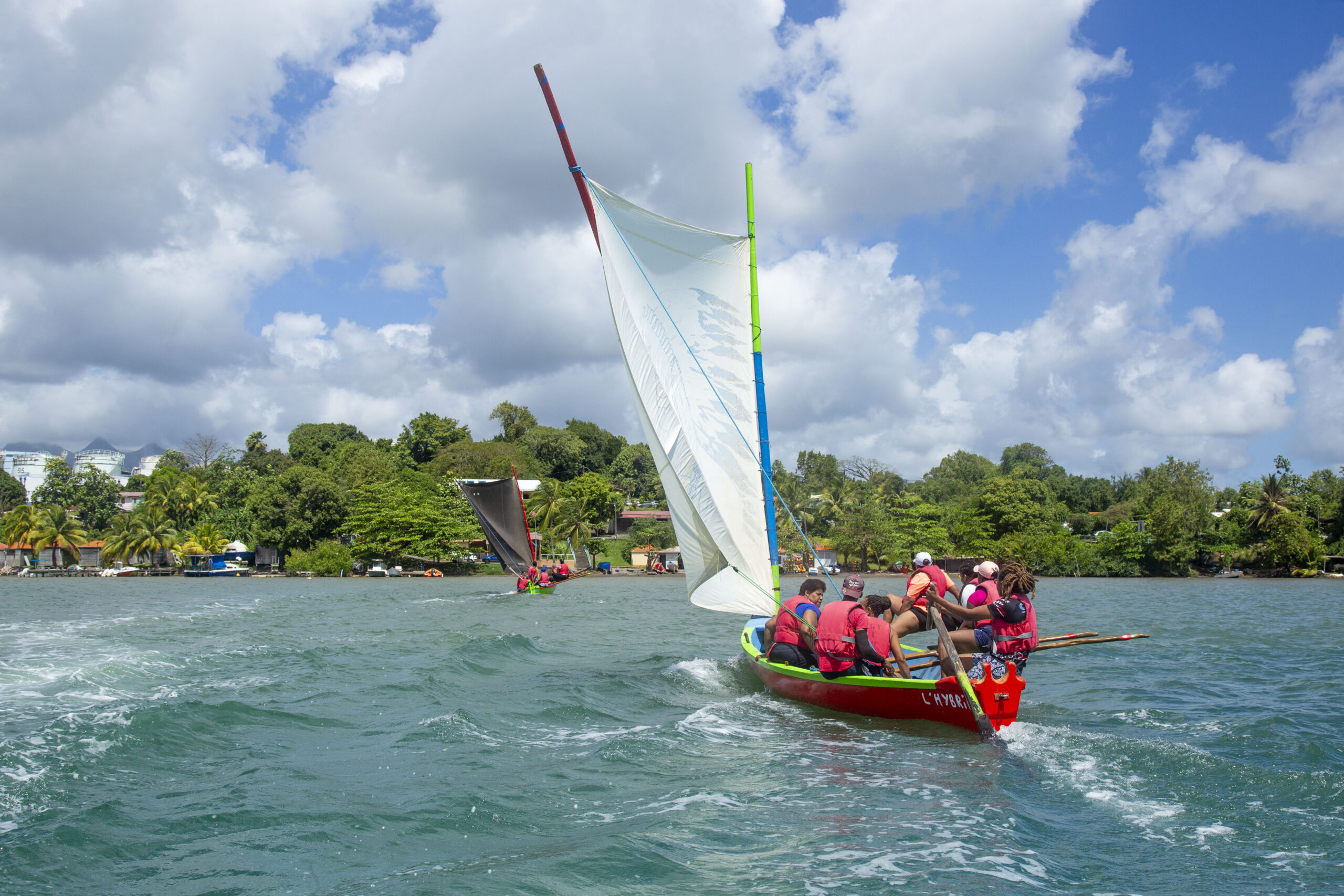
Balade sur la côte Caraïbe en Martinique
École de voile
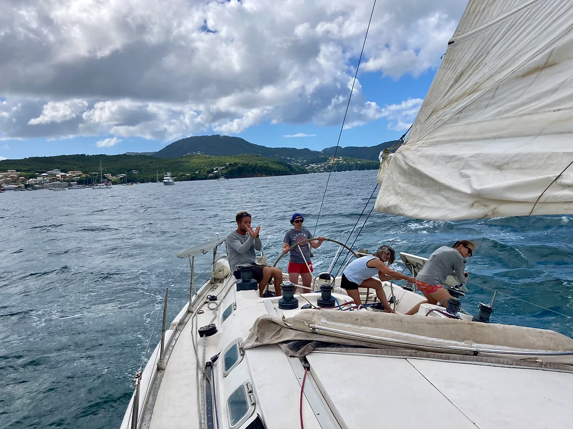
Sortie Journée – Tous niveaux
Cette journée vous offre la possibilité d’acquérir de la technicité et de l’aisance dans les…
avec Caraïbes Sailing
Martinique
Côte Caraïbe
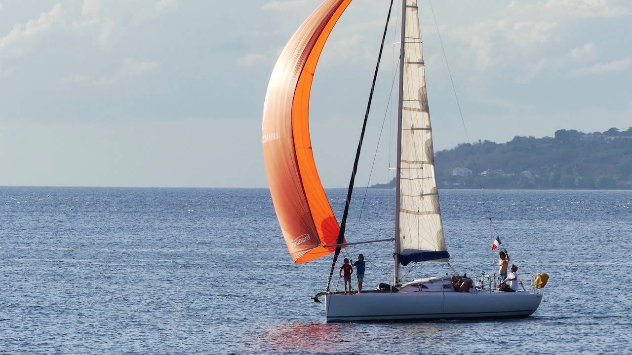
Bateau à voile
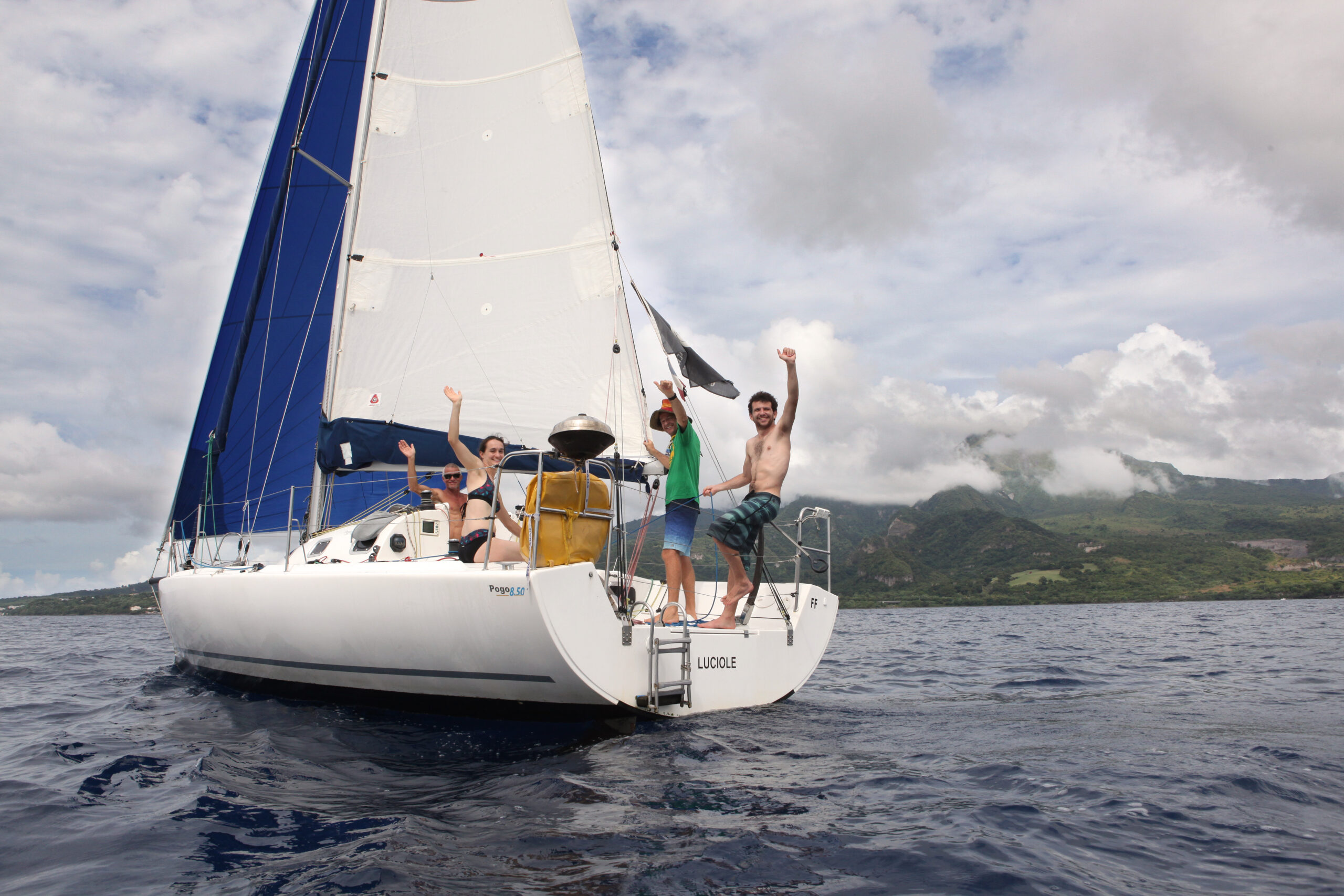
Journée sur la côte Nord Caraïbe
Découverte des plaisirs de la voile rapide sur un voilier de course au large. Sensations…
avec Pogo Luciole
Martinique
Côte Caraïbe
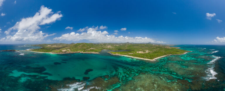
La côte Caraïbe de la Martinique est protégée des alizés par ses massifs montagneux, c’est pourquoi on parle de côte « sous le vent », comme on le ferait sur un bateau.
On peut découper cette côte en deux parties, le Nord et le Sud, avec en son milieu la grande et majestueuse baie de Fort-de-France qui par sa topographie laisse circuler un vent quasi constant venant de l’autre côté de l’île.
Le nord est très escarpé avec ses massifs montagneux encore jeunes, et parfois friables, sa forêt humide et ses authentiques villages de pêcheurs.
Sa partie Sud représente la partie haute de la presqu’île des Trois-Îlets. Elle est jalonnée de nombreux anciens volcans, tout en rondeur, qui séparent les ravines et sont habillés d’une forêt sèche à cause de la faible pluviométrie de la zone.
Tout du long de la côte Caraïbe, on retrouve donc les quatre catégories de littoral : des falaises, des plages, de la mangrove et des constructions humaines.
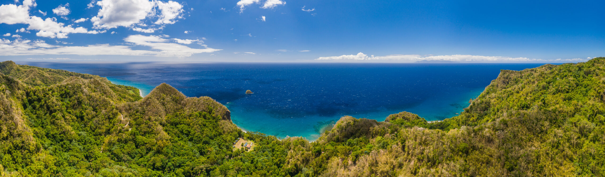
Le nord de la côte Caraïbe et ses plages de sable noir
Depuis le Prêcheur jusqu’à Fort-de France s’enchaînent des baies de sable noir, et l’on passe de l’une à l’autre très souvent sur une route vallonnée, au gré des mornes qui font cette topographie si vivante.
Mais plus on monte vers le Nord, plus la forêt tropicale des flancs de la Pelée jouxte la plage, offrant des paysages paradisiaques et hors du temps. La couleur du sable est due à son origine volcanique. Et lorsque l’on regarde au loin depuis la plage de l’Anse Couleuvre, on peut apercevoir, tel un mirage, l’île voisine de la Dominique.
De nombreuses randonnées, parfois très engagées, sont accessibles autour de la Pelée. Mais certaines ont la spécificité de faire le lien terre-mer. En balade facile, celle de la cascade Couleuvre prend à peine 45 minutes pour lier l’anse Couleuvre à sa cascade, en longeant une rivière d’eau pure. Ici également, les plages sont des zones de ponte de tortues marines, les tortues imbriquées étant les plus régulières à venir y creuser le nid qui abritera leurs futurs petits.
Moins touristiques que le Sud, les villages du Nord de la côte Caraïbe gardent une authenticité reposante loin du tourisme de masse. Depuis la mer, on s’y délecte des falaises aux couleurs variées, fruit de la longue histoire volcanique de l’île.
La formation récente de la Montagne Pelée et des Pitons du Carbet, donne à leurs flancs qui viennent se jeter dans la mer des Caraïbes, des aspects encore instables, avec une érosion donnant des phénomènes plus ou moins impressionnants : du lahar au Prêcheur (des coulées de boues forçant à évacuer une partie de la population de cette petite bourgade dues à des pluies associées à l’écroulement de grandes masses rocheuses) à la formation de plages de galets de tailles divers.
C’est ainsi que certaines falaises semblent depuis la mer bien friables, leurs murs rugueux devenant de véritables abris pour les oiseaux, comme c’est le cas des pailles en queues qui nidifient sur les falaises de l’Anse Four à Chaux, accessible uniquement par la mer. Sur la côte Caraïbe, de nombreux abris, sans accès route, dévoilent un décor sauvage et majestueux.
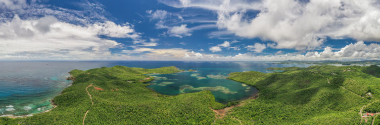
Le centre, sa majestueuse baie de Fort-de-France
La baie de Fort-de-France abrite la plus grande mangrove de l’île. Cette zone humide, est un condensé de biodiversité et une zone de protection que ce soit au niveau écologique (puisque l’eau qui arrive de la terre vers la mer est en partie filtrée par les palétuviers avant de se déverser dans la mer), mais aussi une protection pour le littoral, offrant une véritable barrière face aux intempéries. C’est également une pouponnière pour un grand nombre d’espèces de poissons et une halte migratoire pour pas moins de 93 espèces d’oiseaux.
L’eau calme et le vent presque constant de la baie en font un terrain de jeu parfait pour tous les passionnés de voile. Et on y croise tous types d’embarcations : des monocoques de course croisière, des véliplanchistes à foil, des enfants sur des Hobbies Cat (petit catamaran de course) d’un des nombreux clubs de voile des environs. Parfois, ce ballet prend place autour d’immenses cargos qui patientent dans la baie avant de pouvoir livrer leur marchandise au Grand Port.
De nombreux îlets de la côte Caraïbe, issus du développement volcanique récent de l’île sont regroupés dans cette baie et font partie de la commune des Trois-Ilets. L’un des plus remarquables est l’îlet à Ramier, petit volcan strombolien de seulement 400 000 ans. Cet îlet abrite un fort qu’il est possible de visiter avec l’association Karisko. En face, se tiennent deux anses, bien connues des touristes qui y affluent chaque jour : l’Anse Noire et l’Anse Dufour.
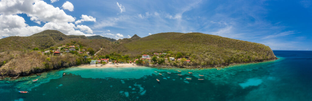
Fait rare, on a, entre ces deux anses, une distinction très nette entre la fin du sable noir et le début du sable blanc.
L’Anse Noire, abritée dans la baie de Fort-de-France, non accessible en voiture, est la dernière plage de sable noir de la côte Caraïbe. Habituellement, il n’y a pas de limite franche entre deux types de substrat sableux. Les mélanges des types de sédiments provoquent des nuances dans les couleurs que l’on rencontre.
Ici, nous avons d’un côté une anse très fermée, avec un relief abrupt, et une ravine déposant des sédiments noirs d’origine volcanique. De l’autre côté, à Anse Dufour, la plage est ouverte, avec très peu d’entrants provenant des reliefs terrestres, et un dépôt régulier de produits de la dégradation des squelettes de coraux et autres organismes marins, dus à une houle et un courant conséquents.
Les fonds marins époustouflants de la côte Caraïbe
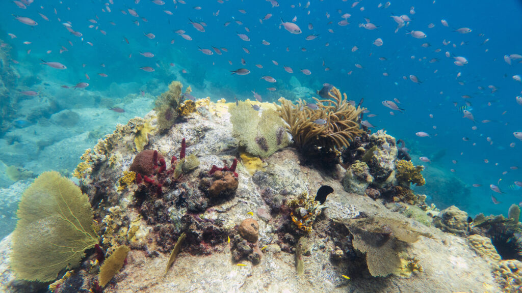
Sur la côte Caraïbe de l’île, la présence corallienne ne s’étend pas sur des kilomètres, comme les barrières de corail côté Atlantique et Sud, mais on y trouve de nombreux hotspots, près des côtes, peu profonds, et donc très accessibles en snorkeling.
De nombreux tombants offrent aussi l’opportunités de plongées plus profondes, en apnée ou en bouteille. L’eau y étant très calme, les activités subaquatiques ont pris un essor très important de ce côté de l’île et vous trouverez, surtout du côté des Anses d’Arlet et des Trois-Îlets, une grande concentration de clubs de plongée.
Les couleurs de la faune fixée (coraux, éponges) mais aussi des divers poissons ou mollusques sont épatantes. Il est également possible de plonger sur certaines épaves, récentes ou plus anciennes, notamment celles datant de l’éruption de la Montagne Pelée en 1902 dans la baie de Saint-Pierre.
Découvrez les balades en mer sur la côte Caraïbe de Martinique